Topografisk kort Πενταμόδι
Interaktivt kort
Klik på kortet for at se højden.
Om dette kort
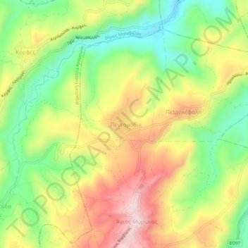
Navn: Topografisk kort Πενταμόδι, højde, terræn.
Gennemsnitshøjde: 262 m
Minimum højde: 90 m
Maksimal højde: 459 m

Klik på kortet for at se højden.
Navn: Topografisk kort Πενταμόδι, højde, terræn.
Gennemsnitshøjde: 262 m
Minimum højde: 90 m
Maksimal højde: 459 m