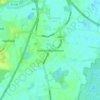
Topografisk kort Edlington
Klik på kortet for at se højden.
Edlington
Edlington Wood is a 99.7-hectare (246-acre) site located at Grid Ref: SK 549980 an altitude of 45–80 metres some 4 km to the south west of Doncaster; this is the largest single unit of predominantly deciduous woodland on the magnesian limestone in South Yorkshire. It includes large areas of ancient woodland dating from Romano-British times and supports extremely rich plant and animal communities which reflect the site's antiquity, history of forest management, diversity of soil types and moisture conditions. Edlington Wood was designated as a Site of Special Scientific Interest (SSSIS) in 1979.
Om dette kort

Navn: Topografisk kort Edlington, højde, terræn.
Sted: Edlington, Doncaster, South Yorkshire, England, United Kingdom (53.45582 -1.20781 53.49087 -1.15807)
Gennemsnitshøjde: 77 m
Minimum højde: 10 m
Maksimal højde: 146 m
Andre topografiske kort
Klik på et kort for at se dets topografi, dets højde og dets terræn.