
Giv en donation
Gør dig klar til dit næste eventyr:
Som Amazon-partner tjener denne side en kommission på kvalificerede køb uden ekstra omkostninger for dig.
Topografisk kort Tancheng
Klik på kortet for at se højden.
Giv en donation
Gør dig klar til dit næste eventyr:
Som Amazon-partner tjener denne side en kommission på kvalificerede køb uden ekstra omkostninger for dig.
Om dette kort
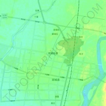
Navn: Topografisk kort Tancheng, højde, terræn.
Sted: Tancheng, Shandong, 276100, China (34.59173 118.31867 34.67173 118.39867)
Gennemsnitshøjde: 41 m
Minimum højde: 32 m
Maksimal højde: 56 m
Giv en donation
Gør dig klar til dit næste eventyr:
Som Amazon-partner tjener denne side en kommission på kvalificerede køb uden ekstra omkostninger for dig.
Andre topografiske kort
Klik på et kort for at se dets topografi, dets højde og dets terræn.
Huancui District
Huancui District is relatively low in elevation, with only a few peaks rising above 500 metres (1,600 ft) in height. The district's southern edge lies along the eastern portion of the Jiaolai Plains [zh].
Gennemsnitshøjde: 41 m
Giv en donation
Gør dig klar til dit næste eventyr:
Som Amazon-partner tjener denne side en kommission på kvalificerede køb uden ekstra omkostninger for dig.
Qingdao City
Qingdao is located on the south facing coast of the Shandong Peninsula (German: Schantung Halbinsel). It borders three prefecture-level cities, namely Yantai to the northeast, Weifang to the west, and Rizhao to the southwest. The city occupies an area totaling 10,654 km2 (4,114 sq mi), and stretches in…
Gennemsnitshøjde: 37 m
Giv en donation
Gør dig klar til dit næste eventyr:
Som Amazon-partner tjener denne side en kommission på kvalificerede køb uden ekstra omkostninger for dig.