
Topografisk kort Helvellyn
Klik på kortet for at se højden.
Helvellyn
Red Tarn, a classic corrie tarn, is a high-elevation tarn with low nutrient levels and poor in the number of species it supports. Characteristic vegetation zones include a water-starwort (Callitriche) in shallower areas and the alga Nitella flexilis in deeper water and around the inlet. Other species include a pondweed (Potamogeton) which grows in 2–3 m (7–10 ft) of water and the rush Juncus bulbosus. Brown trout and schelly, a species of whitefish, are found in the tarn.
Om dette kort
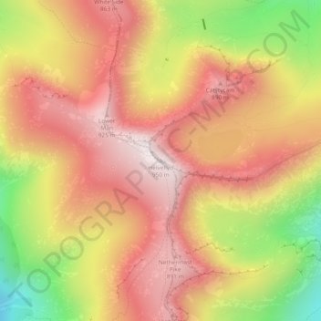
Navn: Topografisk kort Helvellyn, højde, terræn.
Gennemsnitshøjde: 680 m
Minimum højde: 277 m
Maksimal højde: 943 m
Andre topografiske kort
Klik på et kort for at se dets topografi, dets højde og dets terræn.
Brown Cove Tarn
United Kingdom > England > Westmorland and Furness > Patterdale
Gennemsnitshøjde: 699 m
Brothers Water
United Kingdom > England > Westmorland and Furness > Patterdale > Hartsop
Gennemsnitshøjde: 298 m