
Topografisk kort Mambal
Klik på kortet for at se højden.
Om dette kort
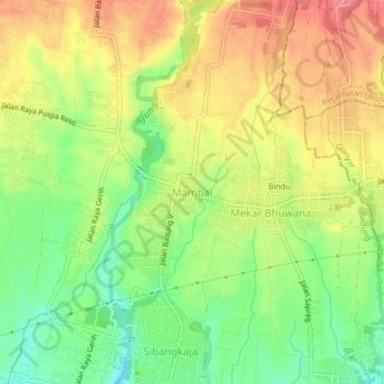
Navn: Topografisk kort Mambal, højde, terræn.
Sted: Mambal, Badung, Bali, Lesser Sunda Islands, 80352, Indonesia (-8.56937 115.20195 -8.52937 115.24195)
Gennemsnitshøjde: 132 m
Minimum højde: 92 m
Maksimal højde: 169 m
Andre topografiske kort
Klik på et kort for at se dets topografi, dets højde og dets terræn.
Pecatu
Pecatu is located in South Kuta District of Badung Regency. It is at the western end of the Bukit Peninsula in south Bali, and has a hilly topography with limestone cliffs isolating small, short beaches that have been privately developed. Nusa Dua, on the opposite side of the peninsula, is flat and is a…
Gennemsnitshøjde: 78 m