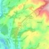
Topografisk kort Dawlish
Klik på kortet for at se højden.
Dawlish
Little of note happened at Dawlish until the end of the 18th century, when seaside locations on the south coast started to become popular with the wealthy, mainly caused by George III making Weymouth in Dorset his summer holiday residence from 1789. In May 1795, the antiquarian and topographer John Swete spent some time in Dawlish and reported that although not long ago it had been no more than a fishing village, and the best lodging house would not cost more than half a guinea per week, it was now so fashionable that "in the height of the season, not a house of the least consequence is to be hired for less than two guineas a week, and many of them rise to so high a sum as four or five."
Om dette kort

Navn: Topografisk kort Dawlish, højde, terræn.
Gennemsnitshøjde: 44 m
Minimum højde: -1 m
Maksimal højde: 248 m
Andre topografiske kort
Klik på et kort for at se dets topografi, dets højde og dets terræn.


Teignmouth Beach
United Kingdom > England > Devon > Teignbridge > Teignmouth > Shaldon
Gennemsnitshøjde: 24 m





Ponsworthy
United Kingdom > England > Devon > Teignbridge > Widecombe-in-the-Moor
Gennemsnitshøjde: 278 m
Heltor Rock
United Kingdom > England > Devon > Teignbridge > Bridford > Westcott
Gennemsnitshøjde: 249 m


Haytor Rocks
United Kingdom > England > Devon > Teignbridge > Haytor Vale > Smallacombe
Gennemsnitshøjde: 354 m


Greatoak Cross
United Kingdom > England > Devon > Teignbridge > Abbotskerswell > Whiddon
Gennemsnitshøjde: 58 m






Southbrook
United Kingdom > England > Devon > Teignbridge > Buckland in the Moor
Gennemsnitshøjde: 239 m




Bonehill
United Kingdom > England > Devon > Teignbridge > Widecombe in the Moor > Bonehill
Gennemsnitshøjde: 354 m



Holcombe Down
United Kingdom > England > Devon > Teignbridge > Teignmouth > Holcombe Down
Gennemsnitshøjde: 101 m


Lindridge Park
United Kingdom > England > Devon > Teignbridge > Luton > Humber
Gennemsnitshøjde: 125 m