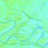
Topografisk kort Siak
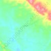
Klik på kortet for at se højden.
Om dette kort

Navn: Topografisk kort Siak, højde, terræn.
Sted: Siak, Riau, Sumatra, Indonesia (0.40758 100.90687 1.24848 102.92236)
Gennemsnitshøjde: 23 m
Minimum højde: -3 m
Maksimal højde: 849 m
Andre topografiske kort
Klik på et kort for at se dets topografi, dets højde og dets terræn.








Tembilahan
Indonesia > Riau > Indragiri Hilir
The soil conditions of the area is mostly composed of peat soil and stream sediment and marshes. The altitude of the District's Government's Centre is from 1 to 4 metres. On the banks of the rivers and in the estuaries trenches there are many plants that grow, such as Nipah trees.
Gennemsnitshøjde: 4 m