
Tak fordi du støtter denne side ❤️
Giv en donation
Giv en donation
Gør dig klar til dit næste eventyr:
Som Amazon-partner tjener denne side en kommission på kvalificerede køb uden ekstra omkostninger for dig.
Topografisk kort Wicklow Head
Klik på kortet for at se højden.
Tak fordi du støtter denne side ❤️
Giv en donation
Giv en donation
Gør dig klar til dit næste eventyr:
Som Amazon-partner tjener denne side en kommission på kvalificerede køb uden ekstra omkostninger for dig.
Om dette kort
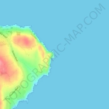
Navn: Topografisk kort Wicklow Head, højde, terræn.
Gennemsnitshøjde: 13 m
Minimum højde: 0 m
Maksimal højde: 87 m
Tak fordi du støtter denne side ❤️
Giv en donation
Giv en donation
Gør dig klar til dit næste eventyr:
Som Amazon-partner tjener denne side en kommission på kvalificerede køb uden ekstra omkostninger for dig.