
Tak fordi du støtter denne side ❤️
Giv en donation
Giv en donation
Gør dig klar til dit næste eventyr:
Som Amazon-partner tjener denne side en kommission på kvalificerede køb uden ekstra omkostninger for dig.
Topografisk kort Brick
Klik på kortet for at se højden.
Tak fordi du støtter denne side ❤️
Giv en donation
Giv en donation
Gør dig klar til dit næste eventyr:
Som Amazon-partner tjener denne side en kommission på kvalificerede køb uden ekstra omkostninger for dig.
Om dette kort
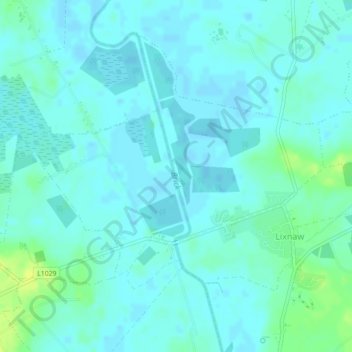
Navn: Topografisk kort Brick, højde, terræn.
Gennemsnitshøjde: 4 m
Minimum højde: -1 m
Maksimal højde: 16 m
Tak fordi du støtter denne side ❤️
Giv en donation
Giv en donation
Gør dig klar til dit næste eventyr:
Som Amazon-partner tjener denne side en kommission på kvalificerede køb uden ekstra omkostninger for dig.