Geolocate

Topografisk kort Buttu Palepong

Klik på kortet for at se højden.

Om dette kort

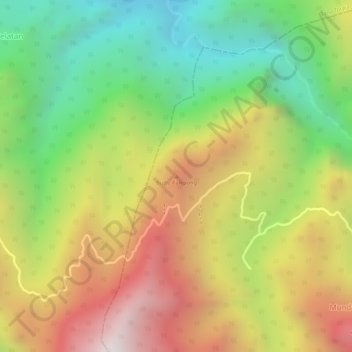
Navn: Topografisk kort Buttu Palepong, højde, terræn.

Sted: Buttu Palepong, Enrekang, South Sulawesi, Sulawesi, Indonesia (-3.29835 119.71855 -3.29825 119.71865)

Gennemsnitshøjde: 667 m

Minimum højde: 183 m

Maksimal højde: 1.172 m

Andre topografiske kort

Klik på et kort for at se dets topografi, dets højde og dets terræn.

Baraka

Indonesia > South Sulawesi > Enrekang

Gennemsnitshøjde: 827 m

Bungin

Indonesia > South Sulawesi > Enrekang

Gennemsnitshøjde: 1.238 m

Buntu Batu

Indonesia > South Sulawesi > Enrekang

Gennemsnitshøjde: 1.459 m

Cendana

Indonesia > South Sulawesi > Enrekang

Gennemsnitshøjde: 152 m

Maiwa

Indonesia > South Sulawesi > Enrekang

Gennemsnitshøjde: 214 m

Malua

Indonesia > South Sulawesi > Enrekang

Gennemsnitshøjde: 709 m

Malua

Indonesia > South Sulawesi > Enrekang

Gennemsnitshøjde: 709 m

Alla

Indonesia > South Sulawesi > Enrekang

Gennemsnitshøjde: 1.037 m

Gør dig klar til dit næste eventyr:

☀️Solcreme til udendørs - Beskytter hud mod solens stråler
📡GPS‑enhed til outdoor - Håndholdt GPS med topografisk kortsupport
🥤Hydration vest - Vandvest til langdistanceture
🧴Vabelplaster - Hurtig lindring og beskyttelse mod vabler
🦺Sikkerhedsudstyr til vandring - Reflekser og nødudstyr til hike

Som Amazon-partner tjener denne side en kommission på kvalificerede køb uden ekstra omkostninger for dig.