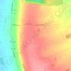
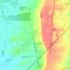
Topografisk kort Haxey
Klik på kortet for at se højden.
Haxey
The civil parish includes the town of Haxey and the village of Westwoodside, and the hamlets of Haxey Carr, High Burnham (the highest elevation of the Isle of Axholme), Low Burnham, East Lound, Graizelound and Upperthorpe which is conjoined to Westwoodside.
Om dette kort

Navn: Topografisk kort Haxey, højde, terræn.
Gennemsnitshøjde: 7 m
Minimum højde: -4 m
Maksimal højde: 42 m
Andre topografiske kort
Klik på et kort for at se dets topografi, dets højde og dets terræn.