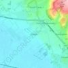
Topografisk kort Airedale
Klik på kortet for at se højden.
Airedale
Airedale, in conjunction with the Ribble Valley, provides low-altitude passes from Yorkshire to Lancashire through the Aire Gap. It is therefore an important transport route and was a strategically important area historically.
Om dette kort

Navn: Topografisk kort Airedale, højde, terræn.
Gennemsnitshøjde: 60 m
Minimum højde: -1 m
Maksimal højde: 375 m
Andre topografiske kort
Klik på et kort for at se dets topografi, dets højde og dets terræn.

Market Weighton
United Kingdom > England > East Riding of Yorkshire > Market Weighton
Gennemsnitshøjde: 43 m












Little Driffield
United Kingdom > England > East Riding of Yorkshire > Driffield
Gennemsnitshøjde: 30 m








East Cottingwith
United Kingdom > England > East Riding of Yorkshire > East Cottingwith
Gennemsnitshøjde: 8 m
















Stamford Bridge
United Kingdom > England > East Riding of Yorkshire > Stamford Bridge
Gennemsnitshøjde: 16 m