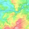
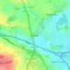
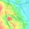
Topografisk kort Tickhill
Klik på kortet for at se højden.
Tickhill
It lies eight miles south of Doncaster, between Maltby and Harworth, on the busy conjunction of the A631 and A60 roads, and adjacent to the A1(M) motorway. It is located at 53° 26' North, 1° 6' 40" West, at an elevation of around 20 metres above sea level. The River Torne passes close to the south-east of the town where it is the boundary between South Yorkshire and Nottinghamshire, eventually meeting the River Trent.
Om dette kort

Navn: Topografisk kort Tickhill, højde, terræn.
Sted: Tickhill, Doncaster, South Yorkshire, England, United Kingdom (53.40574 -1.15179 53.46823 -1.05201)
Gennemsnitshøjde: 28 m
Minimum højde: 3 m
Maksimal højde: 76 m
Andre topografiske kort
Klik på et kort for at se dets topografi, dets højde og dets terræn.