
Topografisk kort Linton
Klik på kortet for at se højden.
Om dette kort
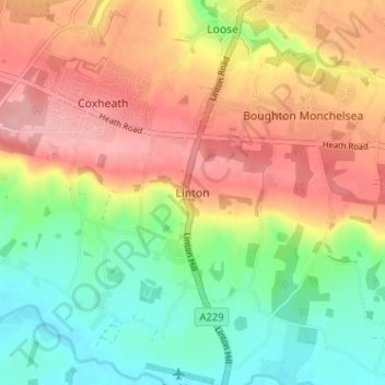
Navn: Topografisk kort Linton, højde, terræn.
Sted: Linton, Maidstone, Kent, England, ME17 4AW, United Kingdom (51.20411 0.49183 51.24411 0.53183)
Gennemsnitshøjde: 71 m
Minimum højde: 10 m
Maksimal højde: 134 m
Andre topografiske kort
Klik på et kort for at se dets topografi, dets højde og dets terræn.
Leeds Castle
United Kingdom > England > Kent > Maidstone > Hollingbourne > Eyhorne Street
Gennemsnitshøjde: 81 m