
Giv en donation
Gør dig klar til dit næste eventyr:
Som Amazon-partner tjener denne side en kommission på kvalificerede køb uden ekstra omkostninger for dig.
Topografisk kort Puerto Limon
Klik på kortet for at se højden.
Giv en donation
Gør dig klar til dit næste eventyr:
Som Amazon-partner tjener denne side en kommission på kvalificerede køb uden ekstra omkostninger for dig.
Om dette kort
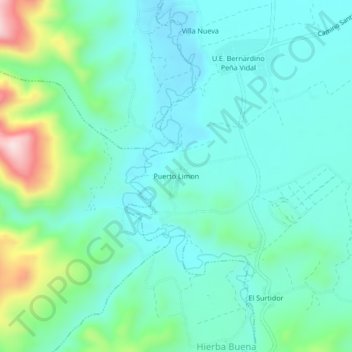
Navn: Topografisk kort Puerto Limon, højde, terræn.
Gennemsnitshøjde: 1.457 m
Minimum højde: 1.377 m
Maksimal højde: 1.744 m
Giv en donation
Gør dig klar til dit næste eventyr:
Som Amazon-partner tjener denne side en kommission på kvalificerede køb uden ekstra omkostninger for dig.
Andre topografiske kort
Klik på et kort for at se dets topografi, dets højde og dets terræn.
Samaipata
Bolivia > Santa Cruz > Provincia Florida > Municipio Samaipata
Samaipata or Samaypata (Quechua samay to rest, pata elevated place / above, at the top / edge, bank (of a river), shore) is a small town in the Florida Province of the Santa Cruz Department in Bolivia. It has a subtropical climate and an altitude of 1600–1800 m. It lies about 120 kilometers to the southwest…
Gennemsnitshøjde: 1.695 m