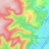
Topografisk kort Long Mynd
Klik på kortet for at se højden.
Long Mynd
Long Mynd comprises a multitude of valleys, and the highest concentration lies along the eastern edge, near Church Stretton. Topographically, many of the larger valleys lie adjacent to each other and are aligned northwest to southeast. The main valleys include.
Om dette kort

Navn: Topografisk kort Long Mynd, højde, terræn.
Gennemsnitshøjde: 292 m
Minimum højde: 141 m
Maksimal højde: 513 m
Andre topografiske kort
Klik på et kort for at se dets topografi, dets højde og dets terræn.

Minton
United Kingdom > England > Shropshire > Church Stretton > Little Stretton
Gennemsnitshøjde: 272 m