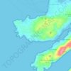
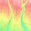
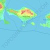
Topografisk kort Tabanan
Klik på kortet for at se højden.
Tabanan
Jatiluwih is an administrative village in Penebel District, north of Tabanan; it is formed with two customary villages, Gunung Sari and Jatiluwih; under these two customary villages there are seven customary hamlets or banjar. The village is at an altitude of 700 meters. Two routes to Jatiluwih are Denpasar > Kediri > Tabanan > Penebel > Jatiluwih or Denpasar > Mengwi > Baturiti > Jatiluwih.
Om dette kort

Navn: Topografisk kort Tabanan, højde, terræn.
Sted: Tabanan, Bali, Lesser Sunda Islands, Indonesia (-8.87058 114.77530 -8.24317 115.21733)
Gennemsnitshøjde: 219 m
Minimum højde: -1 m
Maksimal højde: 2.213 m
Andre topografiske kort
Klik på et kort for at se dets topografi, dets højde og dets terræn.










CitraLand Waterpark Denpasar
Indonesia > Bali > Denpasar > Denpasar Barat > Padangsambian Kaja
Gennemsnitshøjde: 56 m











Point of view on the lake and the mount Batur
Indonesia > Bali > Bangli > Songan B
Gennemsnitshøjde: 1.059 m






Mount Agung
Indonesia > Bali > Karangasem
Australia's Bureau of Meteorology reported on 27 November that ash from the eruption had been observed at an altitude of 9,144 m. By the beginning of December, the eruption reduced to minor emissions of steam and smoke. On 12 December, a picture of the crater was taken showing a steadily growing lava dome…
Gennemsnitshøjde: 2.534 m