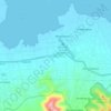
Topografisk kort Tabanan
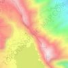
Klik på kortet for at se højden.
Tabanan
Jatiluwih village in Penebel District, north of Tabanan, has paddy fields following the contours of terraced land against the background of spellbinding Mount Batukaru and Mount Agung use traditional Balinese irrigation known as subak, Bali's community-based water control management system. Lies at an altitude of 700 meters, the cool atmosphere of more original beautiful Jatiluwih is better than the most well-known Tegallalang which has plenty of cafes and souvenir shops. Two routes to Jatiluwih are Denpasar>Kediri>Tabanan>Penebel>Jatiluwih or Denpasar>Mengwi>Baturiti>Jatiluwih. Jatiluwih is one of the five rice terraces that describe the "Subak" water management system which has gain acknowledgment from UNESCO as part of the world's cultural heritage.
Om dette kort

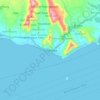
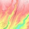
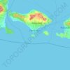
Navn: Topografisk kort Tabanan, højde, terræn.
Sted: Tabanan, Bali, Lesser Sunda Islands, Indonesia (-8.87058 114.77530 -8.24317 115.21733)
Gennemsnitshøjde: 219 m
Minimum højde: -1 m
Maksimal højde: 2.213 m
Andre topografiske kort
Klik på et kort for at se dets topografi, dets højde og dets terræn.











CitraLand Waterpark Denpasar
Indonesia > Bali > Denpasar > Denpasar Barat > Padangsambian Kaja
Gennemsnitshøjde: 56 m











Point of view on the lake and the mount Batur
Indonesia > Bali > Bangli > Songan B
Gennemsnitshøjde: 1.059 m





Mount Agung
Indonesia > Bali > Karangasem
Australia's Bureau of Meteorology reported on 27 November that ash from the eruption had been observed at an altitude of 9,144 m. By the beginning of December, the eruption reduced to minor emissions of steam and smoke. On 12 December, a picture of the crater was taken showing a steadily growing lava dome…
Gennemsnitshøjde: 2.534 m