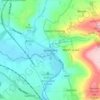
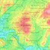
Topografisk kort Pucklechurch
Klik på kortet for at se højden.
Pucklechurch
The land of Pucklechurch is relatively prominent in elevation compared to surrounding areas and as such it was selected in the Bronze Age as the site of a tumulus (round barrow) at Shortwood Hill.
Om dette kort

Navn: Topografisk kort Pucklechurch, højde, terræn.
Gennemsnitshøjde: 98 m
Minimum højde: 48 m
Maksimal højde: 132 m
Andre topografiske kort
Klik på et kort for at se dets topografi, dets højde og dets terræn.

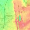

The Slad
United Kingdom > England > South Gloucestershire > Thornbury > Milbury Heath
Gennemsnitshøjde: 75 m




Goosegreen
United Kingdom > England > South Gloucestershire > Frampton Cotterell
Gennemsnitshøjde: 60 m






Little Sodbury End
United Kingdom > England > South Gloucestershire > Horton > Little Sodbury End
Gennemsnitshøjde: 114 m